#What did we develop?
The aim of our project is to develop a way by which the unidentified mangroves can be mapped using remote sensing data from the satellites. Thus by mapping the mangroves, we can have a strategy to conserve them, and also we can improve the vegetation over there. A strategy to map the mangroves using the landcover data is developed in this project.
#Why is it Important?
The aim of our project is to develop a way by which the unidentified mangroves can be mapped using remote sensing data from the satellites. Thus by mapping the mangroves, we can have a strategy to conserve them, and also we can improve the vegetation over there. A strategy to map the mangroves using the landcover data is developed in this project.
#what does it do?
Generally, mangrove forests surround an area where the river and sea meets. Mangrove forests won't form where everywhere the river and sea meet. They require unique and favorable conditions. For instance, The Godavari mangroves (known as the coringa mangroves) are formed where the River Godavari drains into the Bay of Bengal. This Coringa Mangrove Forest surrounds the city ‘Kakinada’ and acts as a natural storm barrier, that protects the city from cyclones and tidal effects. 
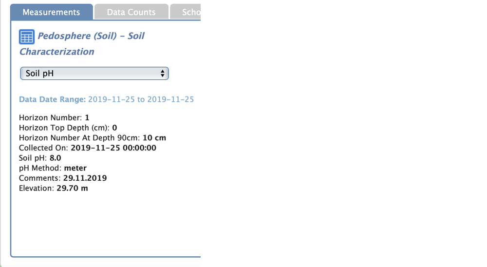
Our project identifies these type of mangroves which are unidentified. After identifying them can aware the people in those regions about them and we can conserve them. we can do that by considering the factors like soil Ph value, the temperature of the region, Ph value of water, and other climatic conditions.
**(The above picture shows the Godavari mangrove river mouth, which is captured by Sohan Seemakurthy)
#How does it work?
Our project works by identifying the points where the river and sea meet thereby classifying the Ph value of soil, type of soil, Oxygen present in the atmosphere, the temperature of the region, and other considerable factors. By sorting out all the factors, we will run a test code that can identify such areas and click the pictures of desired areas. We are only attaching a sample code in the references and not a full version due to a lack of time.
#what did we hope to achieve?
Our sole aim is to conserve the tidal forests as they constitute a unique ecosystem. Many endangered flora and fauna are found in such regions. The animals present in such types of forests are poached and hunted for false use. Mangrove crops have a lot of uses. Their tannin has an antibacterial and vermifuge effect. Somengroves are often used to treat snake bites.
discovering new mangrove crops, we can add up the species population. Finally, We hope to identify all the mangroves present on the earth.
#Species conserved in mangroves:
Mangroves are a habitat for numerous species. The droppings of the migratory birds present in mangroves make the swamps much fertile, thereby providing the plants’ nutrition for survival. These droppings also create fertile breeding grounds for fish, crabs, and shrimp.
In my mangrove region, we can find a lot of endangered species like Fishing cats, Smooth Coated Otters, Golden Jackals, and some more terrestrial mammals are found. The total number of terrestrial mammals is 16. A total of 575 finfish species, 26 species of reptiles, 6 species of whales and dolphins, and 277 benthic organisms are found in Coringa mangroves. By this, we can clearly conclude that mangrove swamps are an excellent habitat for flora and fauna.
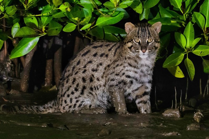
**(the animal in the above picture is a Fishing cat, it is clicked by Srikanth Mannepuri. He's a wildlife photographer and a good friend of us)
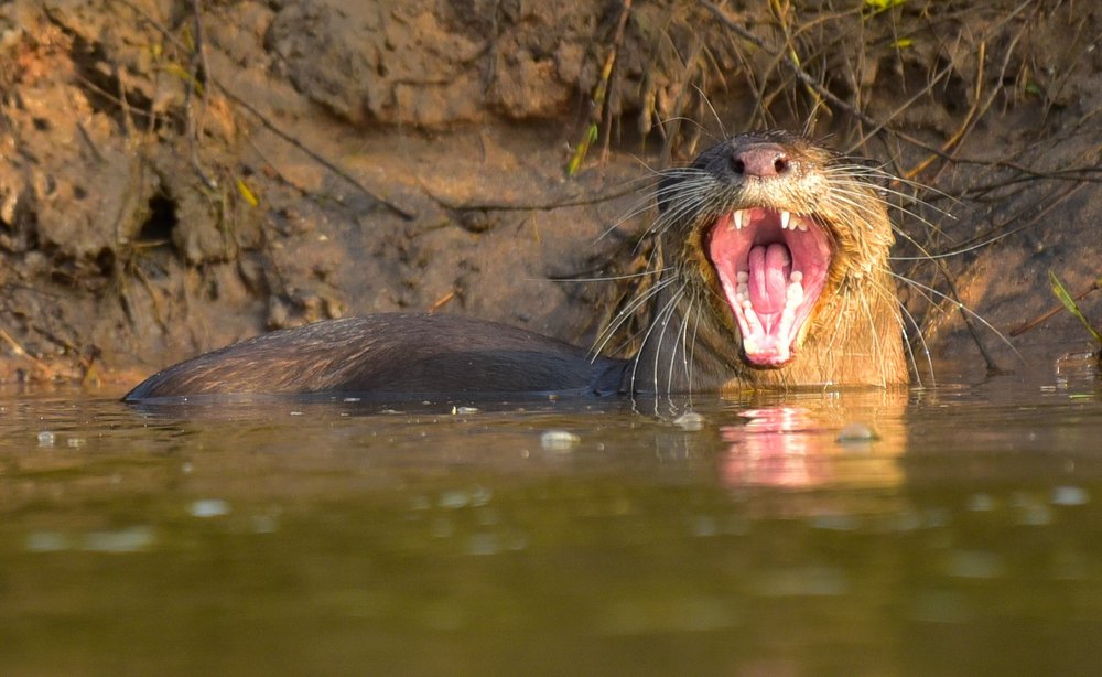
**(this picture is a yawing Smooth-coated Otter, clicked by Srikanth Mannepuri)
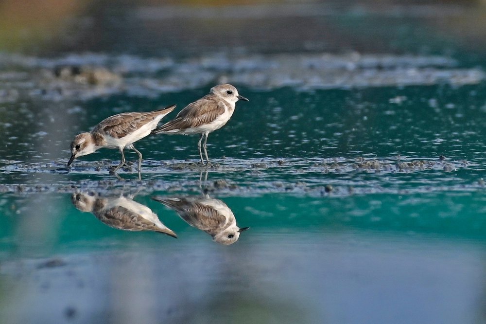
**(these birds are lesser sand plovers captured by Srikanth Mannepuri)