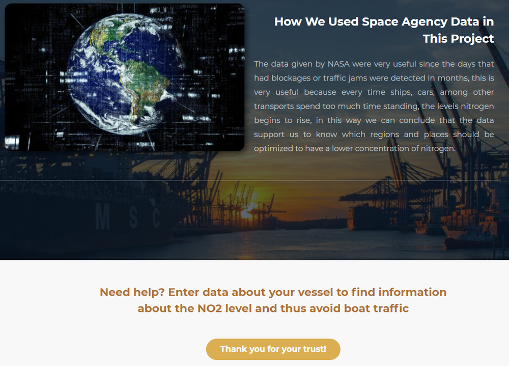
In order to find a solution to the challenge Ship Traffic and the Impact on Air Quality, a web page was developed with the objective of informing and advising the applicant of a ship, regarding maritime traffic and the control of NO2 and SO2 levels during the requested dates, based on statistical data extracted from the EO Dashboard page.
Currently 90% of world trade is conducted via ships, which demonstrates a large and constant daily merchant fleet in the world's oceans.
Maritime traffic, resulting from trade growth, generates an excess of toxic gases from fuel oils, which are a by-product of crude oil distillation residues. This component is the main type of hydrocarbon used as fuel in ships.
It has been proven that excessive emissions of these gases in the air are dangerous for the environment, the union of NO2 and SO2 with the atmosphere produces negative factors, such as acid rain and fractures in the ozone layer; as well as they can produce asphyxia, lung damage and skin damage caused by increased solar radiation.
The operation of the page is based on the use of a form, therefore the user of the page must answer a series of questions, same that will help to have more information of their boat, such as; name, age, cell phone number, email, boat information data: product, boat size, month of departure from port, country of departure, country or city of destination, departure time, etc.
The main objective of this questionnaire is to avoid vessel traffic, and it will also help users to save energy by avoiding being stranded, and in the event that a high concentration of ships is forecast, the navigator will be notified to postpone the departure date.
The purpose of the project is to regulate the levels of toxic gases emitted by commercial ships, estimating the low levels recorded during the Covid-19 confinement. So, we can say that a reduction in the gases emitted by ships would have tangible health benefits, particularly for populations near ports and major shipping routes.
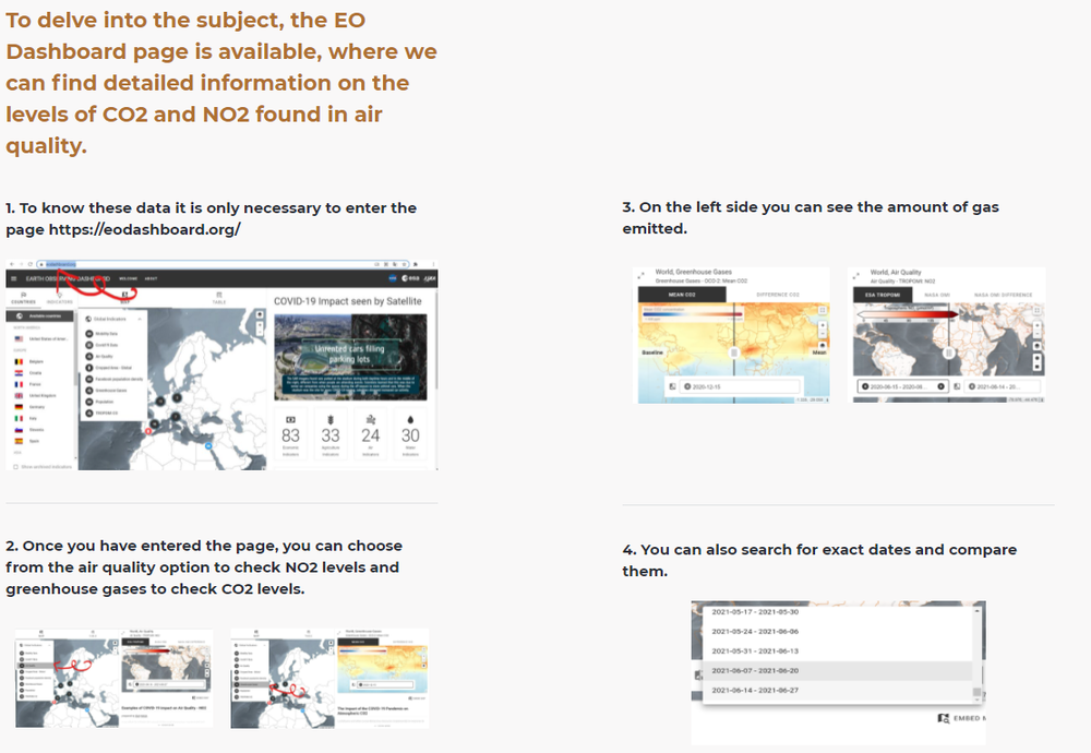
Web page. Own elaboration.